TAA Day 4 - Zion National Park to Socorro NM

Long day today, left the hotel in Zion at sunrise and shot on the way out of the park. Had to deal with construction road closures on the way out of Utah. Lost 1 1/2 hours. Had planned to go to the Grand Canyon but a detour due to another road closure sent me so far away, then dust storms and crappy skies, I finally bailed on the GC. Drove 570 miles, needless to say you will have to wait another day to see the rest of Zion.

Some of today's images will be processed as HDR (high dynamic range). This technique involves taking several images of the same scene and combining them with others that are under and over exposed.

Here is one image from Thursday at Zion. I prefer the B&W version?


TAA Day 3 - Las Vegas to Springdale Utah

Got to Zion in the afternoon. Canyons were too tight for my style, light was not exciting.

Here are a few from Wednesday, have more but need work in post processing.


TAA Day 2 - Bakerfield Ca to Las Vegas

I forgot to mention yesterday, you can click on any image and view it full screen.

Latitude: 35º 06' 37" N Longitude: 118º 20' 16" W Altitude: 3,889 ft

Wind generated power farm - question, there are 38 million people living in California, how many of these will we need to supply power to the entire population?


Can someone explain why there is so much trash along the highways in California? mind boggling!


Latitude: 35º 17' 31" N Longitude: 118º 00' 39" W Altitude: 2,066 ft

Ran into a few run down buildings along the highway, maybe the highlight of the unnatural beauty of the day. This may have been part of some sort of a mining operation.


Latitude: 36º 25' 27" N Longitude: 117º 49' 51" W Altitude: 3,767 ft

A dry lake bed close to Olancha Ca. Very beautiful.


Okay, at this point the iPhone GPS App (GPS-Motion X, highly recommended) stopped allowing me to upload information (but the GPS portion continued to work?) because of not having a cell signal, and I was too lazy to write it all down, the rest are all close to or within Death Valley National Park.


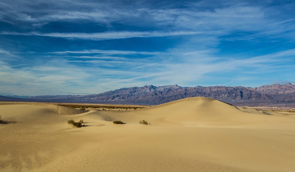
At sea level in the park. In order to not have a million footprints in my images I had to hike about a mile into the sand dunes. Yes, it was hot.


I have to say, the beamer really enjoyed today (note at this point 39.2 mpg!!!) , she was just sippen the fuel, averaging about 34.5 mpg so far on the trip, I expect this to improve once we get to flat land.

And for those of you who pay attention to things like this, on the road to Death Valley today I went past one lone service station, price for diesel, $5.97/gal. Normal prices in California is between $3.95 and $4.30/gal. I'll let you all know the price for the same 1 gallon when I get to Texas.


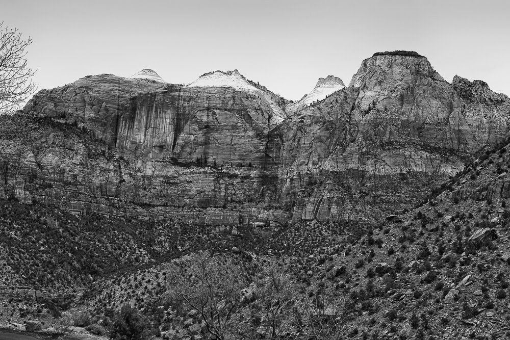
Planned next, driving up into Utah. Gotta go have breakfast.

TAA Day 1 - Aptos Ca to Bakersfield Ca

After a very late start I headed down US1 through Big Sur. Stopped several times and was treated to some stunning West Coast beauty. Unfortunately leaving late meant having to deal with mid-day sun. Anyway here are a couple of rough edits from day 1... Thanks for looking. Next stop Death Valley.

Last Day in Aptos California

Sunday January 26, 2014 was my last day of living in Aptos. Naturally I thought it would be nice to have a image of the final sunset. Unfortunately mother nature threw the marine layer at me and wrecked what I had hoped would have been a stunning sunset. Guess I'll have to return another time and try again.

TAA - details coming soon

The Trip Across America will begin on January 27, 2014. Current routing is California, Nevada, Utah, Arizonia, New Mexico, Texas, .... More details and pictures posting soon.